Global Forest Watch has released a new report based upon satellite data that indicates that forest loss in 2017 was the second highest level recorded. The losses came from agricultural activities and from forest fires associated with high drought levels in Brazil. According to the report:
“In total, the tropics experienced 15.8 million hectares (39.0 million acres) of tree cover loss in 2017, an area the size of Bangladesh. That’s the equivalent of losing 40 football fields of trees every minute for an entire year.”
Global Forest Watch has an impressive interactive map which shows the extent of forest loss throughout the world. There were improvements in Indonesia, but great concern over the rate of deforestation in Brazil, Colombia, and Congo.

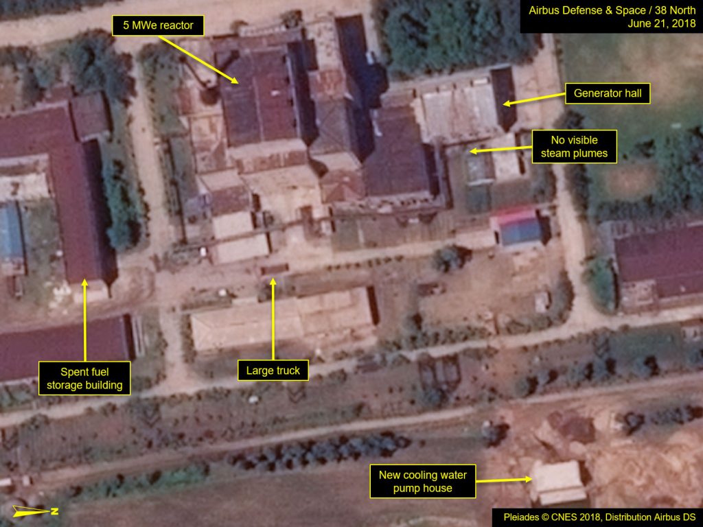
Commercial satellite images indicate that North Korea is improving the infrastructure of the Yongbyon Nuclear Scientific Research Center, a facility that processes plutonium. We cannot glean North Korea’s intent in making these improvements from satellite images, but any improvement of a plutonium processing center seems to be inconsistent with the Trump Administration’s interpretation of the success of the Singapore summit two weeks ago. 38North, one of the most reputable sites on North Korean activities, has published a number of these images and the renovations seem to be quite extensive.

Leave a comment